Hiking on Krk Island: Trails, Views, and Unforgettable Adventures
Table of Contents
Nestled in the northern Adriatic Sea, Krk Island is one of Croatia’s largest islands, located in the Kvarner Bay region. Known for its rich history, stunning beaches, and vibrant local culture, Krk also offers a unique hiking experience that takes you through charming villages, coastal cliffs, lush forests, and rolling hills. Hiking on Krk Island provides both locals and tourists with a beautiful way to explore its diverse landscapes and ancient sites while staying active and immersed in nature.
In this guide, we’ll explore some of the best trails, the island’s unique natural features, tips for safe hiking, and why Krk should be your next hiking destination in Croatia.
Why go hiking on Krk Island?
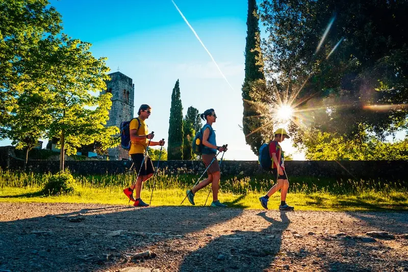
Krk Island stands out as an accessible and appealing destination for hikers of all levels. Connected to the mainland by a bridge, Krk is relatively easy to reach and offers a wide range of trails suitable for beginners to advanced hikers. The island’s diverse terrain makes it a hiking paradise, from the gentle strolls along the coast to more challenging paths through rocky hills and forests.
Hiking on Krk means you can experience its stunning variety of landscapes, from tranquil beaches to rugged hills. Beyond its landscapes, Krk boasts a wealth of cultural and historical sites, including ancient Roman ruins, medieval churches, and traditional stone villages. Hiking on Krk Island offers not only a chance to enjoy nature but also to explore the fascinating layers of Krk’s history and local traditions.
Best Hiking Trails on Krk Island
1. Baška Trails
The town of Baška, located on the southern coast of Krk, is known for its spectacular hiking routes. The most famous trail here is the Vela Luka Trail, which leads you from the main beach in Baška to the secluded cove of Vela Luka. The trail is approximately 8 km one way and provides breathtaking views of the Adriatic Sea and surrounding islands.
Along the way, hikers will pass through rocky terrain, Mediterranean shrubs, and karst landscapes. Another popular route is the Moon Plateau Trail (Mjesec Plateau), a unique, rocky area that looks like a lunar landscape and provides a different kind of hiking experience with panoramic views over the entire island and the mainland.
2. The Kornić to Stara Baška Trail
For hikers interested in coastal and rural scenery, the Kornić to Stara Baška Trail is a stunning route that takes you through both picturesque countryside and coastal cliffs. Starting in the village of Kornić, this trail heads south through a combination of olive groves, vineyards, and open fields before reaching the seaside village of Stara Baška. This 13-km trail offers a moderate challenge, with a few steeper sections, but rewards hikers with incredible views of the Adriatic Sea and nearby islands.
Hiking on Krk along this trail is especially popular for sunset treks, where the colors of the setting sun reflect beautifully over the coastal landscape. Stara Baška’s secluded beaches at the end of the trail also provide an inviting spot to rest or swim before heading back or arranging for transport. This Kornić to Stara Baška route highlights both coastal and rural elements of the island, providing a wonderful alternative for hikers who enjoy natural scenery combined with a bit of relaxation by the sea.

3. Vrbnik to Punat Trail
The Vrbnik to Punat Trail offers a gentler hike along the eastern part of the island, perfect for those looking for a mix of hiking and beach exploration. Starting in the historic town of Vrbnik, the trail ends in Punat, a charming coastal town known for its marina and the small island of Košljun.
This 9-km trail is relatively flat, passing through vineyards, olive groves, and several beaches along the way. Many hikers enjoy stopping for a swim or picnic on the shore, making it a fantastic choice for a full-day excursion. Hiking on Krk along this trail lets you experience the island’s natural beauty while discovering its idyllic shoreline.
4. Omišalj Forest Trail
In the northern part of the island, the Omišalj Forest Trail provides a peaceful hiking experience through dense forests and tranquil bays. This trail is suitable for beginners and families, as it offers a relatively easy path with plenty of shade and scenic spots to rest. The trail circles the Omišalj Bay and includes views of Soline Bay, famous for its mud baths with alleged healing properties.
This trail is approximately 7 km and features unique flora and fauna, including oak and pine forests, typical of the Mediterranean. For those seeking a quiet and serene hike, hiking on Krk through Omišalj’s lush forest is the perfect way to escape into nature.
Flora and Fauna of Krk Island
Krk is home to a variety of plant and animal species, making it a paradise for nature enthusiasts. The island’s vegetation includes typical Mediterranean plants such as olives, figs, lavender, and rosemary, which fill the air with their distinct aromas. As you hike, you may spot rare bird species like the Griffon vulture, along with local wildlife such as rabbits, foxes, and even wild boar in some of the forested areas.
In the coastal areas, you’ll find endemic plant species that have adapted to the island’s karst landscape, including various types of orchids. Hiking on Krk offers an opportunity to connect with this rich biodiversity and immerse yourself in the island’s natural world.
Preparing for Your Hike on Krk
When planning a hike on Krk Island, there are a few practical considerations to ensure a safe and enjoyable experience:
- Choose the right trail: Make sure to select a trail that matches your fitness level and experience. Some routes, like The Kornić to Stara Baška Trail, are best suited for experienced hikers, while others, such as the Omišalj Forest Trail, are perfect for beginners and families.
- Wear appropriate gear: The terrain on Krk can be rocky and uneven, so good hiking boots are essential, especially on trails with steep or uneven sections. In the summer, lightweight, breathable clothing and a hat are recommended to protect against the strong Mediterranean sun.
- Stay hydrated and bring snacks: Many trails don’t have facilities, so pack enough water and snacks, especially if you plan to hike longer distances. In the warmer months, staying hydrated is crucial due to the high temperatures.
- Check the weather: The climate on Krk can be unpredictable, especially in the off-season, so check the weather forecast before you go. Avoid hiking during extreme weather conditions, particularly in winter, when some trails can become slippery and dangerous.
- Respect local nature and wildlife: Krk’s natural environment is fragile, so remember to respect local flora and fauna by sticking to marked trails, not disturbing wildlife, and taking all trash back with you.

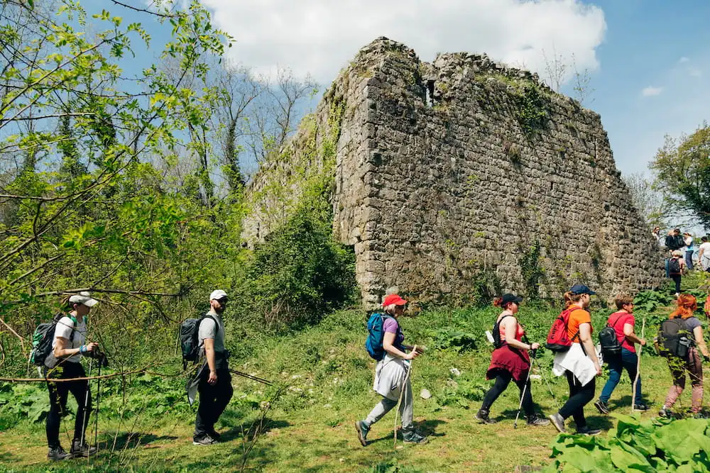
Hiking Events and Groups on Krk
Krk Island is also known for hosting various outdoor and hiking events throughout the year, providing opportunities for both locals and visitors to experience group hikes and explore the island with experienced guides. The Krk Trail is one of the most popular annual events, attracting trail runners and hikers who want to experience the island’s best routes with a competitive twist.
For those who prefer a more relaxed experience, several local hiking groups organize regular meet-ups, offering guided hikes that introduce participants to lesser-known parts of the island. Hiking on Krk in a group setting can be an exciting way to explore while also meeting like-minded outdoor enthusiasts.
Final Thoughts
Hiking on Krk Island is a unique experience that combines natural beauty with a sense of history and adventure. Unlike mainland Croatia, Krk offers a quieter, more laid-back atmosphere that allows you to truly immerse yourself in nature. The island’s varied trails cater to all levels, making it easy for both beginners and experienced hikers to find routes that suit their preferences. And with an abundance of beaches and scenic picnic spots along the way, every hike can be a well-rounded experience combining activity, relaxation, and discovery.
Whether you’re a seasoned hiker or a casual traveler looking to explore Krk’s hidden gems, the island’s diverse trails offer something for everyone. From scenic coastal paths and challenging mountain routes to historic trails leading to ancient fortresses, Krk is a destination that invites you to step out of the everyday and into an adventure that’s both serene and exhilarating. With proper preparation, respect for nature, and a spirit of exploration, hiking on Krk Island will reward you with stunning views, quiet moments in nature, and a deeper connection to Croatia’s rich heritage.
If you need help organising your activities or booking the best tours to explore the island and it’s surrounding, feel free to contact us. And if you need a place to stay, check out our selection of accommodation on the island of Krk.